HOW TO SURVIVE A SOLO TREK THROUGH THE BOB MARSHALL WILDERNESS, MONTANA : PART 6
Mandy Mohler
Continued from PART 1 + PART 2 + PART 3 + PART 4 + PART 5
Wrapping things up here, this will be my final post on the Bob Marshall Wilderness solo adventure story. This will highlight the final four days of the trip, taking me from Rock Creek to My Lake, along the final stretch of the Chinese Wall, to Cliff Mountain, Indian Point, the Prairie Reef Lookout, then out to the Benchmark Trailhead at Augusta.
Please follow along for a photo heavy story culminating with a short film created from footage I captured on the trail.
Day 5 of the hike, I rose early at the Rock Creek Cabin knowing that I had another long day ahead of me. It was imperative that I was able to hike all the way through the lower section of the Chinese Wall just beyond Cliff Mountain, because there is a no camping restriction zone just below the wall. I had to get through 11.5 miles in one big push.
The first four and a half miles took me out of the cool dewy Rock Creek area then up to the hot and dusty burned out trail up Spotted Bear Pass.
Below is an example of many of the obscure trail signs in the Bob. It's important to check your map in situations like this.
I kept to the low left trail, taking the My Lake trail, and bypassed Larch Hill Pass.

Some obscure Bob Marshall Wilderness signage
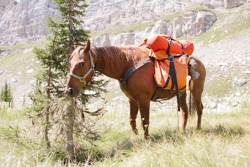
My Lake was nothing short of stunning. It was a sweet little parked out area, with some great camping spots nearby. I wish I had pushed myself a little harder the day before and made ground to camp here instead of at Rock Creek. There was ample grazing for Ben and much better scenery.
I stopped here for a little less than an hour. I tied Ben up to a tree while I pumped water from the lake, and captured a little footage. Of course, Ben didn't take the opportunity to graze... he reserved that for walking. This never ceased to perplex me.

My Lake, Bob Marshall Wilderness, Montana
Just under two and a half miles past My Lake is another great sighting of the Chinese Wall. This lower section is even more dramatic, and is the biggest photo op of the trip.
Here is a photo of Ben, seemingly annoyed, being tied to a tree while I set up the tripod for a walking shot:
Ben and the start of the southern section of the Chinese Wall, Bob Marshall Wilderness, Montana
At this time, we encountered wonderful chest deep beargrass along the base of the Chinese Wall.
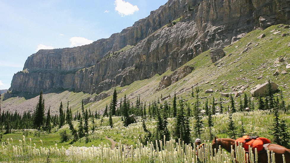
Tall beargrass and the Chinese Wall, Bob Marshall Wilderness, Montana
We hiked around the windy trail at the base of the Wall for a little over four miles. At that point, we climbed out of the valley floor and made our way up to a high vantage point just below Cliff Mountain. This was without a doubt the most scenic part of the trip.
Even thought it was starting to get late, I knew that if there was a time to take a picture- it was NOW. I needed to get this classic photo- even just to fulfill a promise to the people that helped me get here. So, I went about tying Ben to a gnarly windswept tree while I set up the tripod for our selfie. As usual- I made sure to toss my ski poles away from him so they wouldn't get smashed in his destructive wake.
It took a few tries to set the timer and get positioned in the frame just right, but we got it! I was able to capture the quintessence of our journey!

Ben and I looking over the Chinese Wall from Cliff Mountain, Bob Marshall Wilderness, Montana
I took down the tripod, repacked the camera in the pelican case, then put the kit back in Ben's packs. As I walked away from the photo site, I realized I couldn't remember where I left my ski poles. Everything in the vicinity looked so similar. Everything was dry twisty wind swept wood emerging from whitish grey rock. I spent the next thirty minutes walking up and down the hillside, retracing my steps until I was able to find the poles. When I finally found them, I collected them and hurried back down the other side of the hill in search for our new campsite.
What we found below was the most gorgeous campsite yet. It was lush green grass near a babbling brook hidden amidst a spattering of mature trees. I found a great spot to tie a high line for Ben, and he seemed pretty happy there. I brought him buckets of water from the stream nearby, and let him graze for the duration of the evening.

Watering Ben on the highline.
I spent the remainder of the evening setting up camp, cooking food, capturing a little footage, and enjoying a campfire late into the inky night.

Dinner spot below Cliff Mountain, Bob Marshall Wilderness, Montana

Evening campfire below Cliff Mountain, Bob Marshall Wilderness, Montana.
On day 6, I let myself have a leisurely start, knowing that the bulk of that day's hike was going to be a moderate downhill trail to Indian Point.
It was such a leisurely start that I ended up leaving one of the tree straps from my high line setup wrapped around a tree at the campsite.
Other than that, this hiking day went off without a hitch, and we covered the ten miles easily. We arrived in the heat of the day to find very dry barren ground with very poor grazing.
I picked a campsite that was arguably too close to the trail, but this was the place where I was intending to meet up with my husband- and we didn't have a location really set in stone- so I wanted to make sure he didn't pass me by accidentally.
Because I skipped my Gates Park camp site, I was a day ahead of schedule, and was unsure whether Josh would join me early- or keep to our originally planned schedule. In case he came early, and my camp site wasn't obvious enough, I made a make shift sign from a page ripped out of my journal and duct taped it to a tree.
I spent the rest of the evening rolling large rocks out of the way for Ben's highline. I had less options available to me now- and had a shorter rope length because I left the tree strap back at Cliff Mountain.
Ben was not in love with this camp site. The geography of the area forced us to be a bit of a distance apart- more than usual, and he was in a fairly brushy rocky spot, with almost no grazing. I felt bad for him and continued to supplement his feed with my excess breakfast oats. He was very grateful for this.
Day 7 was the rest day that I had earned by skipping past Gates Park. I spent the morning at the river near camp pumping water, doing dishes and washing some clothes. While I was there, a pack string with horses and mules went splashing through the river and down the trail.
Back at camp, I had hobbled Ben to keep him from digging in my absence. With the commotion of the pack train blazing past I was sure he was working himself into a tizzy. I bet he thought we were all leaving without him, and he had been left there alone.
I quickly packed up my chores at the river and made my way back to the camp where I found Ben in a set of broken hobbles. He was pretty worked up and pawing the ground. Thankfully, he was still secure on the high line.
Feeling bad for him, I took him bareback, out of camp and spent an hour or two in search of grazing. There wasn't much to be had, but it seemed that he was grateful for my company and happy not to be packed.
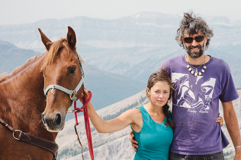
Later that afternoon, anxiously anticipating my husband's arrival, I saddled Ben and rode him for the first time of the trip. We rode out at a casual walk for about four miles before I encountered Josh on the trail. Amazingly, I was able to walk down the trail, in the middle of an open field, towards Josh, for several minutes before he noticed me. How one sneaks up on someone on horseback... I'm not sure.
It was really great seeing his face for the first time in a week. I hopped off Ben and greeted him excitedly. I offered to carry Josh's pack on the back of Ben's saddle- "Heck Yes" was his reply. So we proceeded, and then I led the way back into camp.

Prairie Reef Lookout about the Chinese Wall, Bob Marshall Wilderness, Montana
On Day 8, the three of us climbed the five and half miles of trail straight up to the Praire Reef Lookout. I had made plans to meet Greg Shatz and his wife Deborah up there for a photo. Greg and Deborah are members of the Backcountry Horsemen and well versed in the ways of the Bob. Greg was a huge help in the planning of this trip - and I promised him that I would get a photo of him and his wife with their horses at the lookout.

Greg and Deborah Shatz of the Backcountry Horsemen at the Prairie Reef Lookout above the Chinese Wall, Bob Marshall Wilderness, Montana

Greg and Deborah Shatz of the Backcountry Horsemen at the Prairie Reef Lookout above the Chinese Wall, Bob Marshall Wilderness, Montana
I have to say, these are probably the best family photos I've ever captured! It was also great to meet up with more familiar faces.
Caretaker of the Prairie Reef Lookout, Bob Marshall Wilderness, Montana
Josh, Mandy and Ben at the Prairie Reef Lookout, Bob Marshall Wilderness, Montana

Windy Ben at the Prairie Reef Lookout, Bob Marshall Wilderness, Montana

Plant study at the Prairie Reef Lookout, Bob Marshall Wilderness, Montana
On Day 9, we completed the last leg of the journey and hiked out nine or so miles to the South Fork of the Sun River and the Benchmark Trailhead in Augusta. Along the way we saw other hikers, fresh berry filled bear scat, and more burned forest.
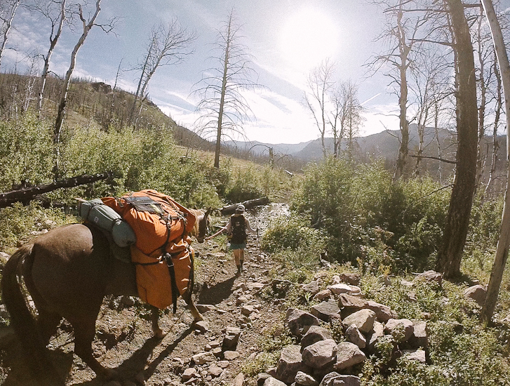
Hiking out to Benchmark Trailhead, Bob Marshall Wilderness, Montana

Crossing the final pack bridge to Benchmark Trailhead, Bob Marshall Wilderness, Montana
I don't think I've ever seen a horse more eager to jump into a horse trailer in my life! Little did he know that he still had a several hour drive ahead of him. But he managed it gracefully. Ben was one hell of a trooper on this trip, and I was so grateful for his company.

Crossing the final pack bridge to Benchmark Trailhead, Bob Marshall Wilderness, Montana
It was somewhat bittersweet to leave the trail behind, but it was also nice to be passenger in the truck, and to put my feet up for the journey home.

Horses on the road, leaving the Benchmark Trailhead, Bob Marshall Wilderness towards Augusta, Montana
Some takeaways for those that are thinking of mounting a trip like this :
Take more food than you think for your stock. Grazing is never a guarantee- and they will eat their weight down the further they go. Ample food is a huge contribution to an animal's mood and overall well-being, and it will make you happier too! I wish I would have taken half as much food for me, and twice as much food for Ben.
Give yourself a little wiggle room in your schedule- so you have time to take in the scenery, take pictures, draw- or whatever you please. You don't want to feel like you are on a time table. The goal is to get off the schedule.
If you get a map, make sure it's Cairn Cartographics. The accurate trail mileage is a life saver! It is a must for trip planning!
Go outside your comfort zone. It turns out we are a lot more capable than we think we are. It's pretty rewarding to prove this to yourself.
Plan a trip, then actually go! You won't regret it!

Leaving the Benchmark Trailhead, Bob Marshall Wilderness towards Augusta, Montana
Once again, a HUGE THANK YOU to everyone that helped make this happen. And thanks to everyone for your patience! I know it's taken me forever to finish this project. But I hope it was worth your support.
Enjoy this video that I made of the trip. As always, the oh so talented Jeri Rafter edited my footage for me.
I hope this story has inspired you to plan a trip of your own!
I'd love to hear your comments - and feel free to leave me questions if you have some!
Thanks for making it this far!